

On Sunday, June 15, 2008, we drove the length of Washington State Route 10, from somewhere between Cle Elum and Thorp all the way to somewhere between Thorp and Ellensburg. And then we drove back to Thorp, but that's a different story.
RCW 47.17.045
State route No. 10:
A state highway to be known as state route number 10 is established as follows:
Beginning at a junction with state route number 970 at Teanaway junction thence easterly to a junction with state route number 97 west of Ellensburg.
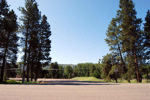
Once upon a time, US 97 came to a T at US 10 at this spot. 10 used to go east-west through here, while 97 went northward. Now, SR 970 is continuous on a curve to the west and north, while 10 gets the T. Is that fair?
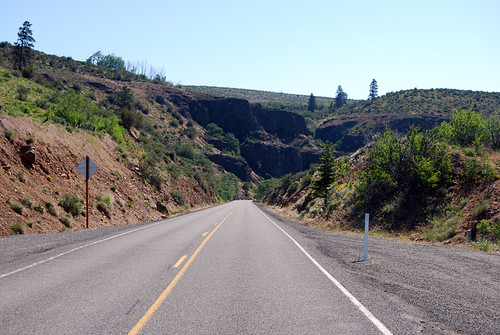
SR 10 doesn't have any junctions in its length, so I stopped halfway for a shot. This is in the Yakima River canyon below Thorp Prairie, just east of Swauk Creek. Two railroads weave through the canyon down below, with the river. It's a scenic stretch of highway, for sure.
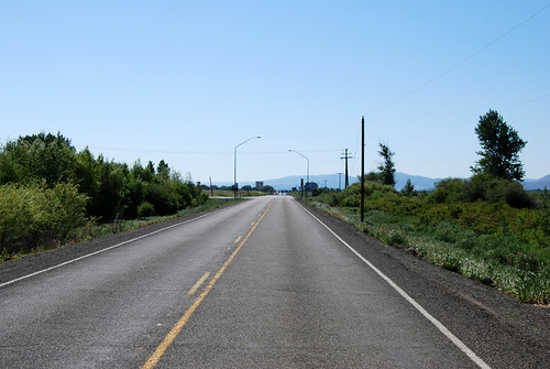
And just a few miles later, we hit the new junction with US 97, on the western outskirts of Ellensburg. The canyon is over and we're out on the Kittitas plains.
All that's left of US 10 in Washington State was that short but sweet 16 miles, down the "quiet side" of the river.


6 comments:
Only one railroad goes through the canyon these days. The other has been converted to a scenic bike path known as the Iron Horse State Park.
The maps you are using are obviously from Wikipedia.
Yes. The creator of the maps entered them into the public domain, free for all to use. And I thank him.
The user's name is NE2 and his userpage on Wikipedia is [http://en.wikipedia.org/wiki/User:NE2 here]
Actually there is more of US 10 left in the state. If your turn off @ Ritzville and stay on Danekas Rd. You would be on Old US 10. It crosses the overpass at the Tokio Weight Station. It continues on south of the I-90 becoming Max Harder Rd. You go through Sprague, WA and spit back out on I 90 30 miles from Spokane.
One of these days, I'll have to drive the old highway routes, like 10, 410, 99, and such. But for now, I'm driving the official routes, and the official routes are just pieces.
Post a Comment